


?")


")


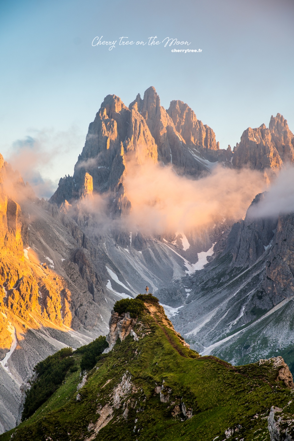
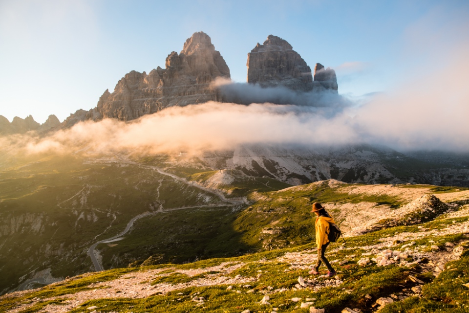
Tre Cime with its 3 legendary peaks at an altitude of more than 3,000 m, the boundary between Austria and Italy as well as the boundary between the Italian-speaking region and the German-speaking region in the region of Trentino/Alto Adige. The spectacular, magnificent beauty of Tre Cime, of the pale undulating mountain peaks, of the mottled forest edges, can hardly be fully described in any frame or word. That beauty can only be fully admired with the eyes, with the feeling of each visitor when he finds himself so small in the midst of the wonder of nature. Today, I will share with you my experience of trekking Cadini di Misurina hike (Cadini di Misurina Italy) with the most beautiful viewpoints in Tre Cime, Dolomites.
- Venice blog: Must things to do & How to spend 48 hours in Venice
- The Bird Paradise Singapore review: How to get, what to do, tips & MORE
- 24 Exciting Experiences in the Warner Bros Studio Tour Tokyo – The making of Harry Potter
- The Detailed Guide of Nong Nooch Tropical Garden in Pattaya, Thailand
- The ULTIMATE guide to Manila Ocean Park
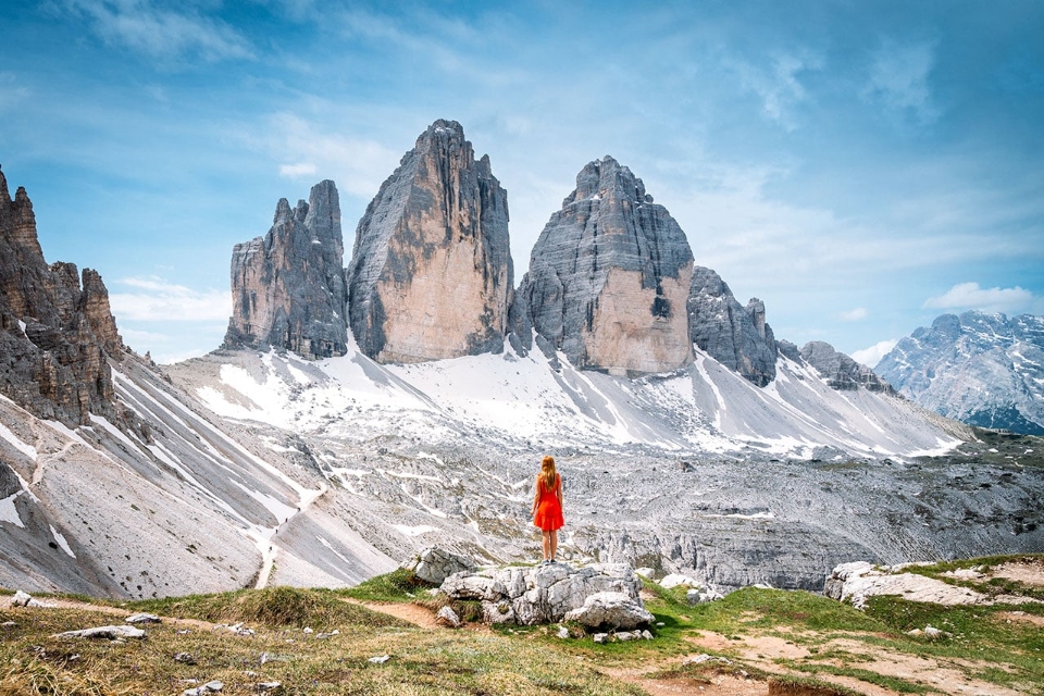
Tre Cime Natural Park, the symbol of the Dolomites
Dolomites, Northern Italy, an early July night.
The summer was at its freshest and warmest.
I groped in the dark, looking for a car parked in the middle of an empty parking lot, no one in sight. At an altitude of more than 2,300m, so even in the middle of summer, the temperature tonight will not exceed 5°C. The thick night fog seemed to be just waiting for the sun to go down behind the mountains to seize the opportunity to gather densely, unable to see anything more than an arm’s length away. My two teeth were chattering.
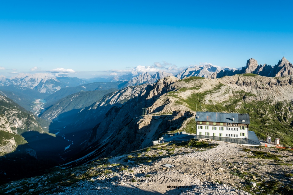
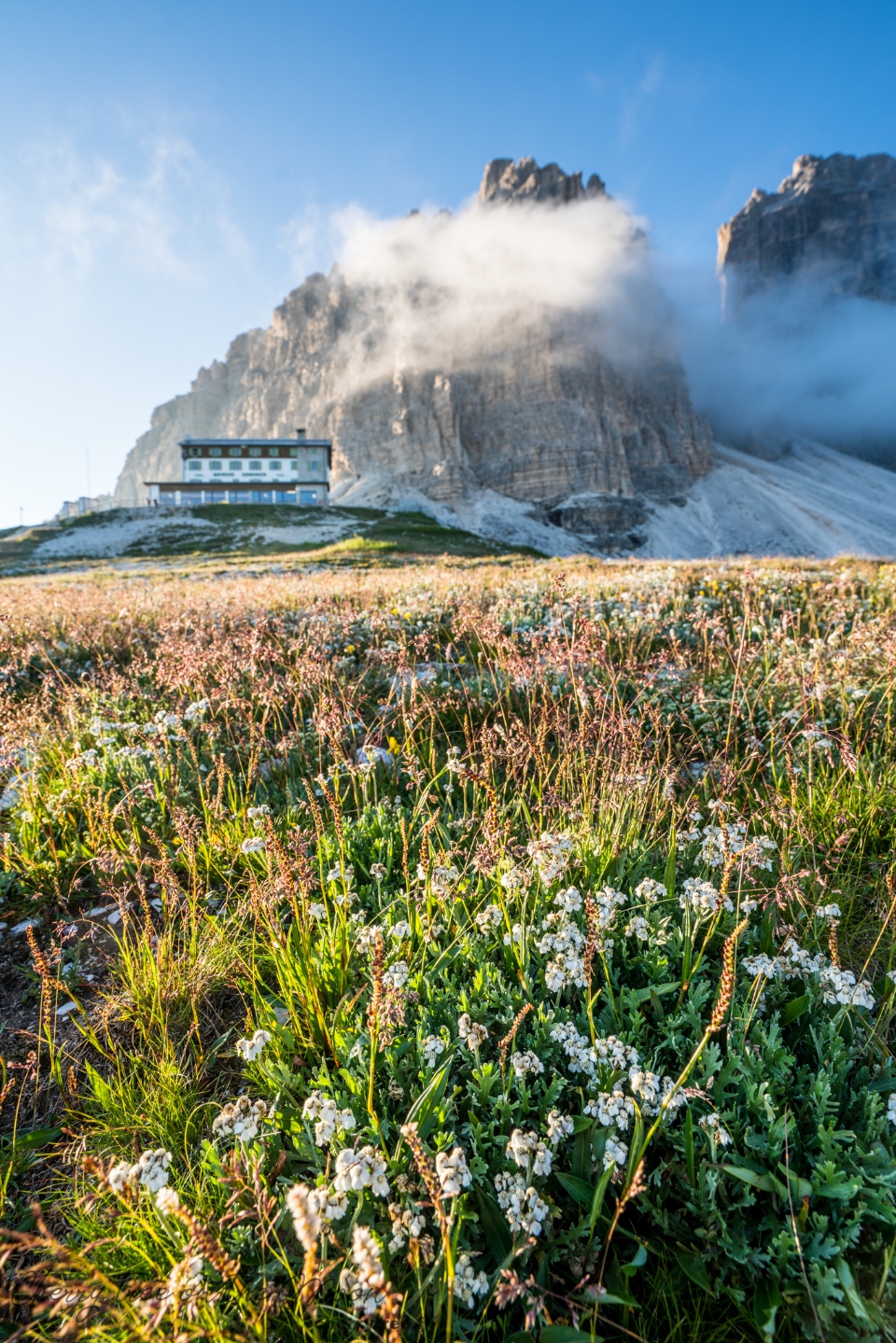
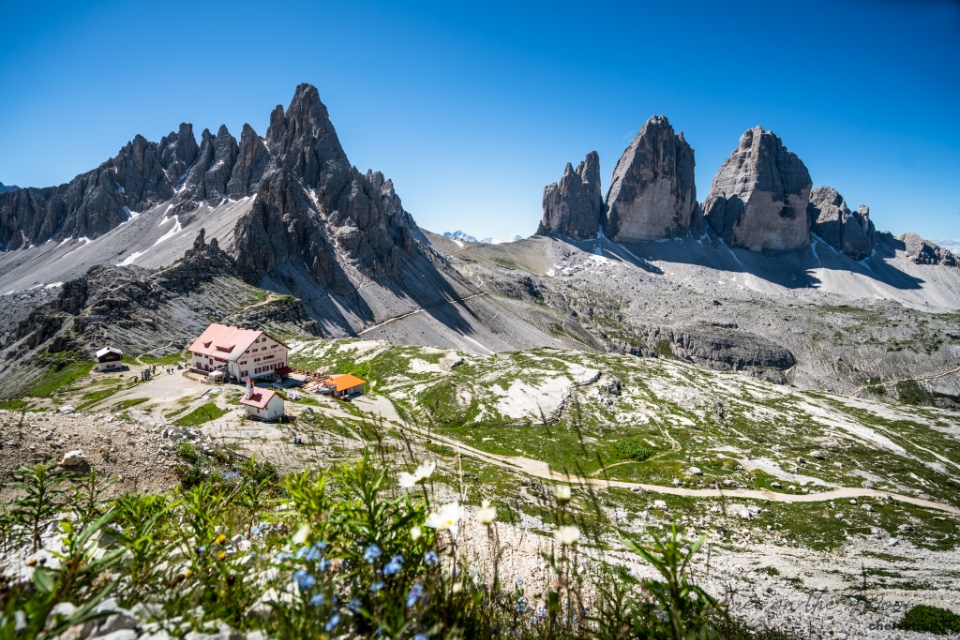
A few hours earlier, the parking lot of rifugio Auronzo was full of cars. Rifugio, Italian, generic term for simple huts (shelters), usually made of wood in the high mountains. Rifugio Auronzo is one of the largest, most solidly built huts in the region and has a large parking space in front. This is the gathering point of all kinds of motorbikes, cars, camping vans… of tourists when they visiting Tre Cime National Park, roughly translated as “Three Peaks”, the symbol of the Dolomites. I came here when the afternoon was almost over and the sun was slanting. Rarely come across a parking lot with such a great view, I chose the most beautiful spot, facing the valley and Lake Misurina, enjoying the view from the car, and wondering if I should start the 3rd hike of the day or not.
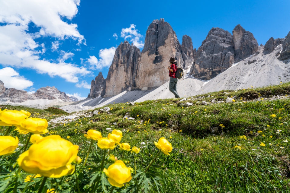
Hiking to Cadini Di Misurina (an awe-inspiring mountain group) opposite Tre Cime
- Trailhead: Refugio Auronzo
- Difficulty: Very easy
- Distance: 3.5 – 4.5 km
- Elevation: 130 m up, down
- Trekking time: 1.5 – 2h
- Type: 2-way, going, returning on the same way
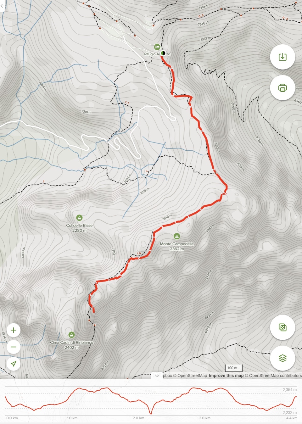
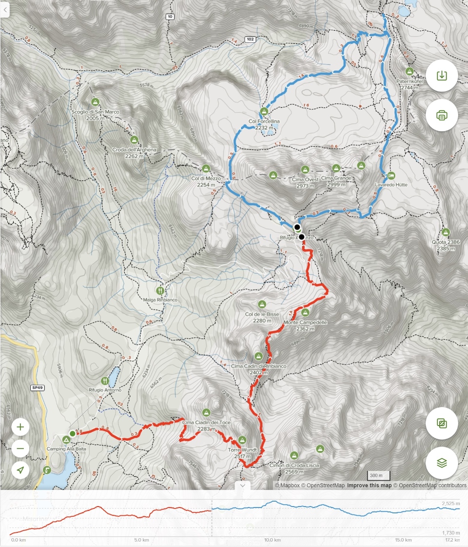
- Map: Click here to open the map.
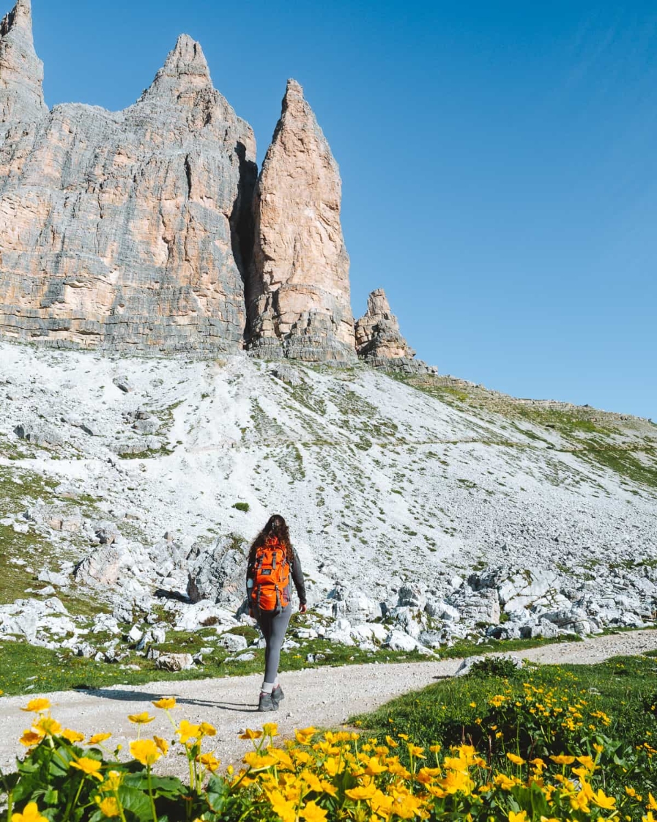
The hiking trail that I intend to take connects between the parking lot of rifugio Auronzo and the “divine” viewpoint looking at the majestic peaks in the Cadini mountain group. It is a short hike of the trail 117.
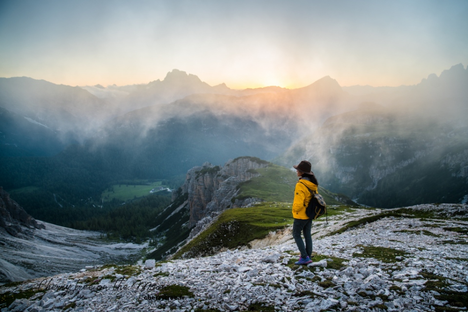
I had exhausted after a long day, which started at 4am, followed by 2 hikes to Lake Sorapis and a group of 5 peaks of Cinque Torri. Both of these hikes are relatively short, approximately 10km each (provided you don’t cross or turn) and are must-see destinations when exploring the Eastern Dolomites. It was a bit late at that time, 7pm, only about 2 hours before it would be completely dark. But outside, the afternoon sun was yellowing the hillside. The sky was clear, a little cloudy, promising a brilliant sunset. The pointed peaks of the Cadini di Misurina cluster were gradually turning a pale purple in the distance, extremely inviting.
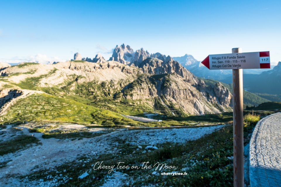
The trailhead marker is located right in front of the rifugio Auronzo, pointing in the opposite direction from Tre Cime. That means, when standing in the parking lot, if rifugio Auronzo and the 3 massive peaks of Tre Cime are behind you, then Cadini di Misurina will be in front of you. This stretch is so short that, standing at the beginning, you can almost see the end, and vice versa. Therefore, calling this a hiking route sounds a bit exaggerated. Maybe it’s just a scenic route.
From inside the car, I saw the trail descending a slope and up several hills, before disappearing from the view. It probably took about 40 minutes to get there, I estimate, then took a deep breath and stuck my head out. The yellow sun thought it was warm, but it turned out that the cold wind was numb. It took courage once more, I was able to get the whole my body out of the car and went straight down the slope. Now, if I regret it, it was too late and lazy to crawl back to the car, then I kept going on.
However, the fatigue accumulated from the early morning quickly disappeared. With the afternoon sun was getting brighter and brighter, the scene in front of you is more and more splendid. The afternoon sun pierced through the transparent wildflower petals, making them look fragile. The clouds were thin and light, dyed with sunlight, at first yellow, then orange and finally light pink.
Like I thought, this trail was very easy to hike, just follow the symbols drawn in red and white paint on the rocks. Sometimes, there were more high stone mounds left by previous climbers. You can choose the shortest route, along the “back”, connecting the highest part of the hilltops, up and down according to the terrain. Or you can also choose the detour at the foot of the hill, which is flatter but there will be a bit narrow and one side is a deep abyss. In short, any road is fine, as long as you go in the direction of Cadini di Misurina, you will definitely reach the famous viewpoint.
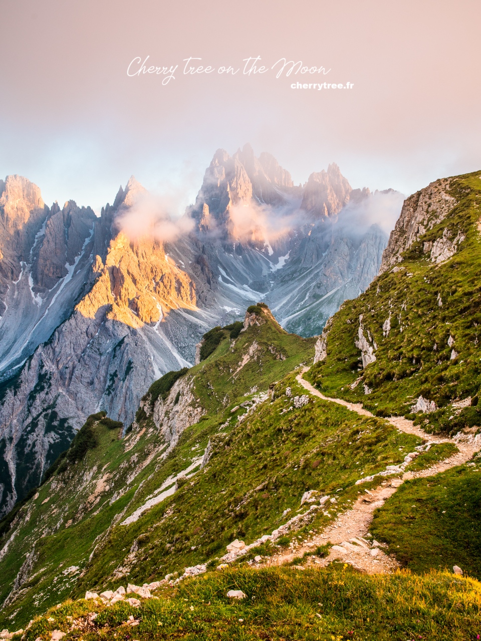
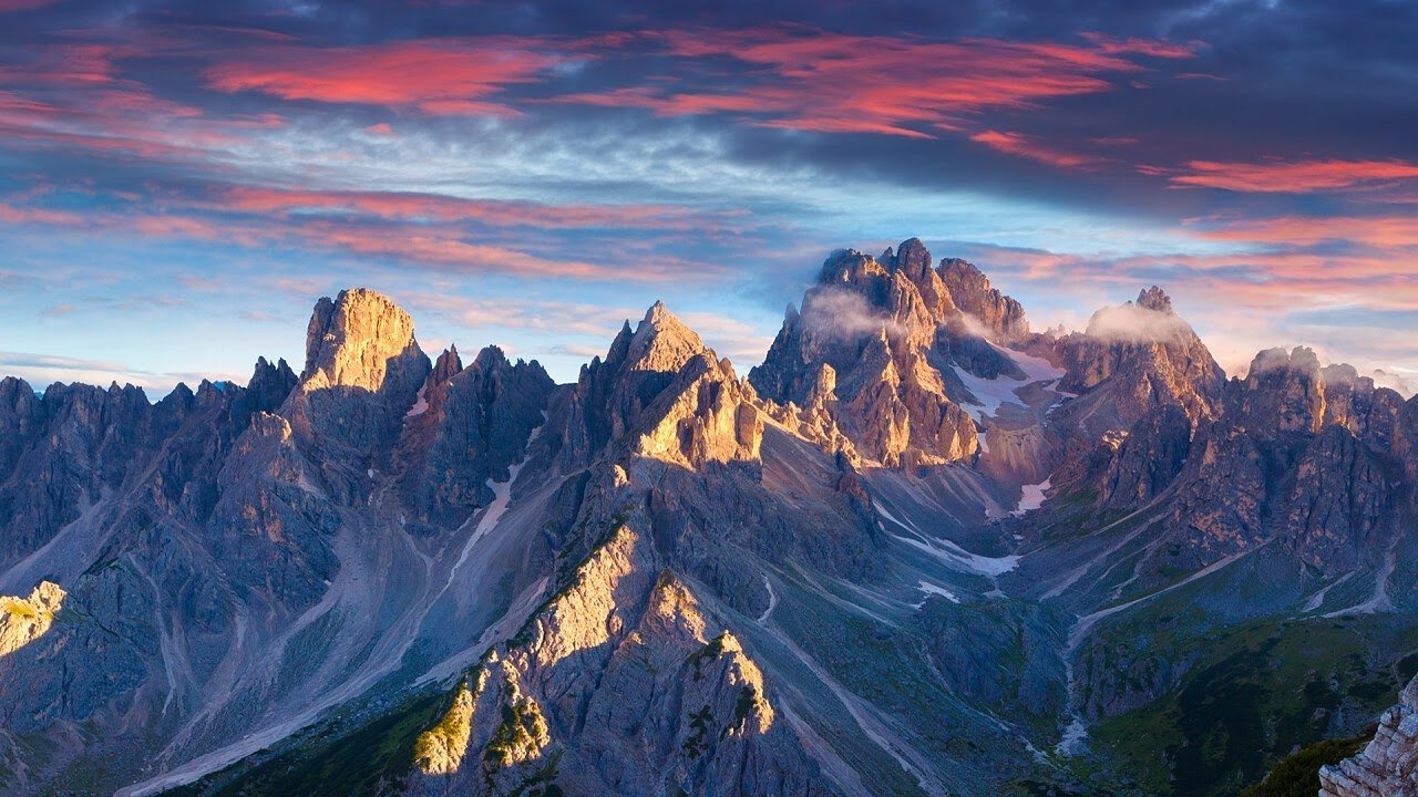
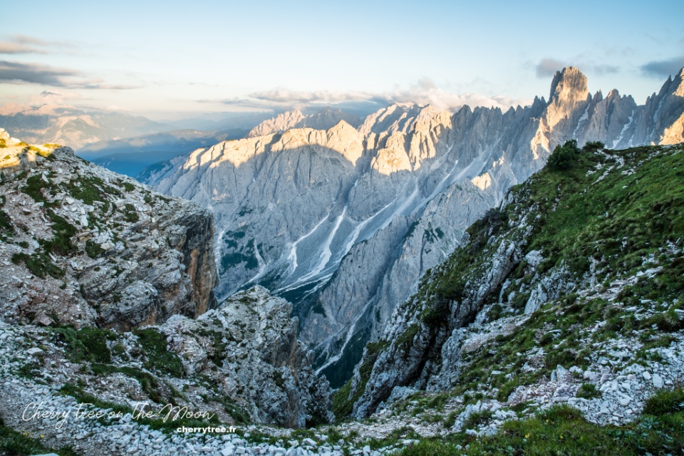
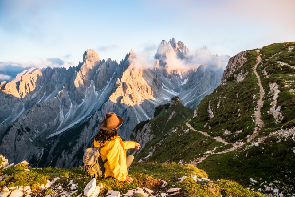
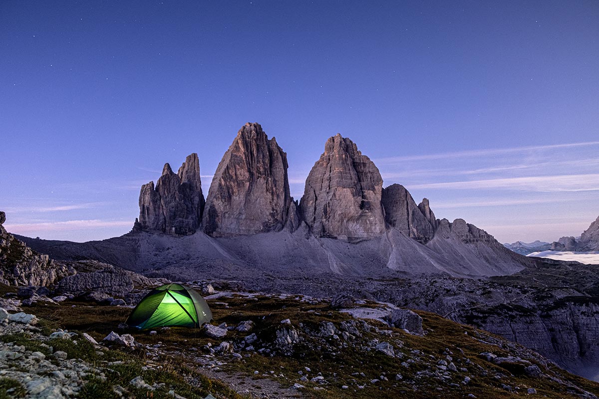
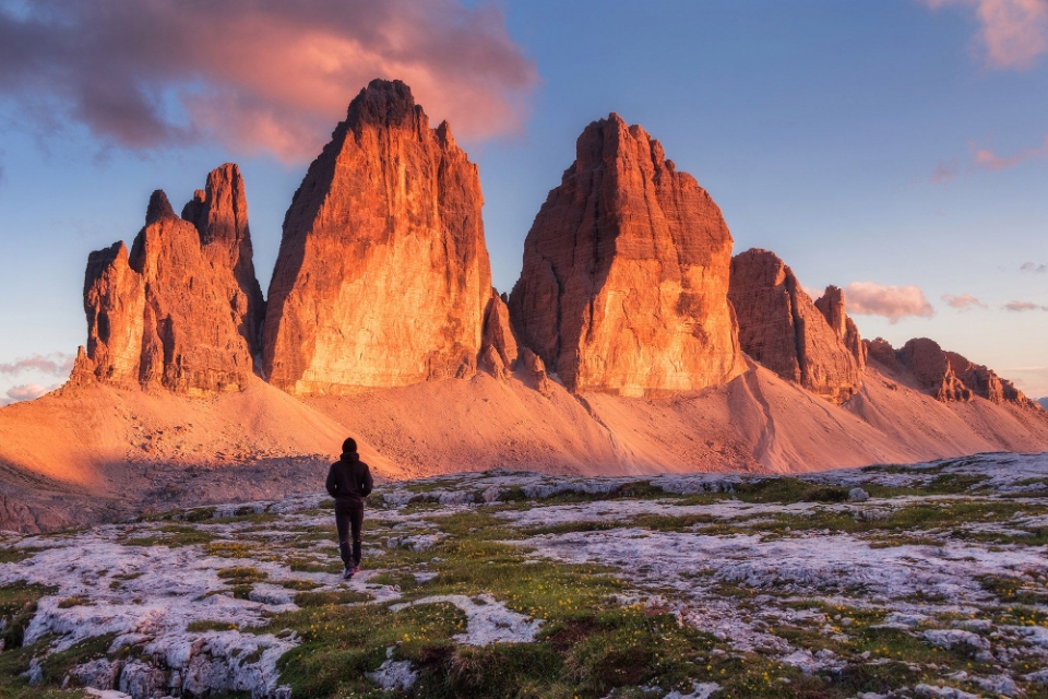
I reached the top of the highest hill just in time for sunset. For an instant, magical light enveloped the landscape on all sides, making them appear in their most glorious form. In front, the dew condenses into clouds, embracing the sharp peaks. Cadini cluster consists of many peaks of approximately 2700, 2800 m, appearing and disappearing in the dance of clouds.
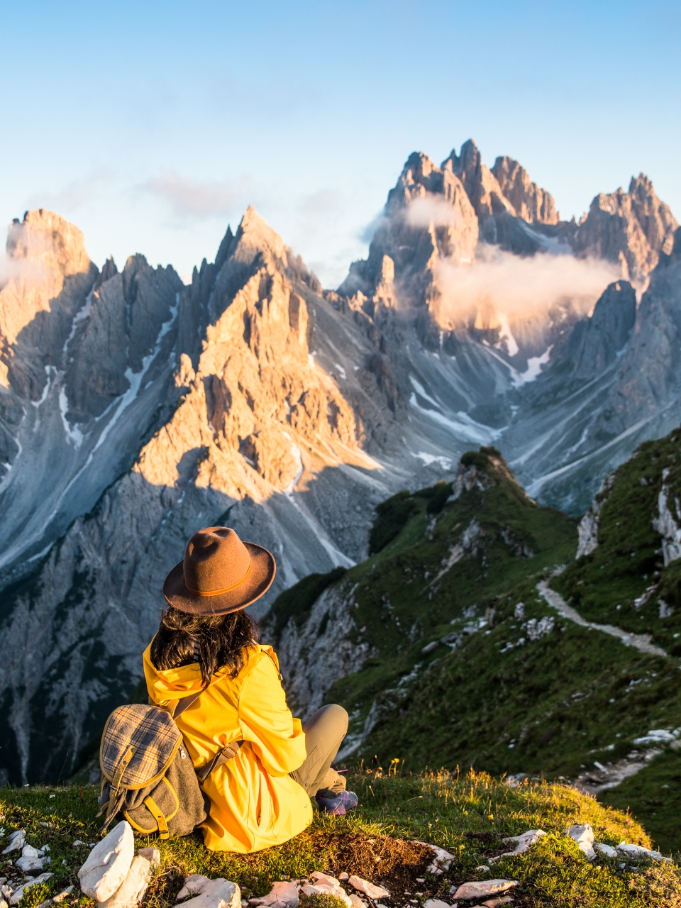
On the other three sides, the undulating mountains like jagged teeth turned deep purple, and then gradually transformed into ghostly black shadows imprinted on the darkening sky. It’s hard to believe that those mountain ranges millions of years ago were once submerged coral reefs. Later, they were fortresses, natural walls protecting the Ladin people in the area from foreign invasion, preserving their culture, preventing their language from being lost, and preserving ancient legends from thousands of years. Even now, when most of Europe’s small peoples have long since disappeared, there are still more than 30,000 Ladin people living in the remote valleys of the Dolomites.
The legends of the Ladin
The sun went down at the same time the moon rose. The pale moonlight scattered in the mist reminded me of a Ladin legend about the moon princess. Because of her love for a prince, she left the Moon to come to Earth to live with him. The prince asked the Dwarves to turn the peaks of the Dolomites into the color of the pale Moon, hoping that the princess would ease her homesickness. The mountains of the Dolomites have since been called “pale mountains”.
But the dew fell quickly, obscuring the Moon. There was no other light to help me navigate, not even the light of rifugio Auronzo. I was too far away from it. Tre Cime’s huge shadow gradually sank into the darkness. I headed towards that direction in the thick, milky light. With a view of only a few meters, I looked at my feet while walking, because in the afternoon I saw a pretty deep abyss on one side of the hill, but only God knows where I was standing.
The rocks on the surface in this area have strange shapes, which I have never seen anywhere else. They have the color of calcium, white in the dim light, and had smooth, round, and concave edges like bones. I felt like I was walking in the middle of a monster’s graveyard. Suddenly, I understood why the ancients always considered mountains and forests as a source of supernatural power. They imagined many dark forces and put them into legends. Thus, the tales of the Ladins in the Dolomites sound like criminal case reports. Like: a drunken woodcutter was grabbed by a giant and thrown into a tree; or young girls being led into the forest by a witch… Sort of, every time you step out the door, you run the risk of being “bullied” by an invisible or visible force.
This reminds me of what Robert Macfarlane wrote in one of his books: “What we call ‘mountain’ is actually a combination of the natural structure of the world and the human imagination – is the mountain in the mind”. Indeed, our imagination can be completely different from what is in reality, so each person’s feelings will rarely be the same.
Things to prepare when hiking in the mountains
After struggling for a while in the foggy night, I got back into the car, started the engine and turned on the heater to full capacity. It was only 5 degrees Celsius outside now, the temperature was not very low, but the air was saturated with water vapor plus sweat, making me almost drenched from inside to outside. A certain book I once read said “there is no cold weather, only the clothes you wear that don’t fit”. Since I did not intend to go to the Dolomites at first, the only warm coat I prepared for this European roadtrip this time was a raincoat. But no one wears a raincoat to climb the mountain. It has a very photogenic yellow color but is not airy at all. Even though I knew that, at that time I had no other choice.
If you have some preparation in advance, during a hike of about a week in the summer, you should bring:
- 1 3-in-1 jacket, consisting of 2 separate layers, outside is a Gore-tex waterproof windbreaker, inside is a life jacket or thin felt.
- 2 thin thermal vests.
- 2 t-shirts.
- 2 pairs of thin and quick-drying hiking pants.
- 2 pairs of turtleneck socks.
- 1 pair of hiking shoes.
- 1 pair of flip flops or slippers.
- Climbing stick if you are used to it.
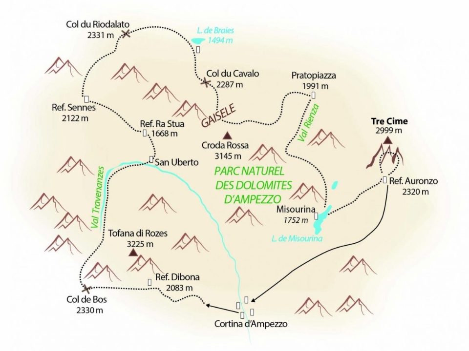
How to get to Tre Cime Park?
To get to the Tre Cime park, you need to pass through Lake Misurina. From here you have 2 options: keep driving up or leave the car and walk.
Getting to Tre Cime by car, tolls and parking
A little beyond Lake Misurina, you will come to a toll station to go to Tre Cime. In 2021, the fare is € 30/4-seater car, higher for camping cars and vans, cheaper for bicycles and motorbikes.
From the toll station, go another 6.5 km, you will reach the main parking lot in front of the rifugio Auronzo with the beautiful view I mentioned in the first part.
This parking is free, unless you stay overnight, pay an additional €15/van or camping car. I drove a small car, stayed overnight and did not see anyone asking for an extra fee.
Hike up Tre Cime from Lake Misurina
Right in front of the above toll station, there is a free parking lot for those who want to stop here and hiking up Tre Cime. The entrance to Tre Cime is free for walkers.
From here, a hiking trail (approximately 4 hours, 8 km, 900 m D+) will lead you to in front of the rifugio Auronzo. This hike passes through rifugio Fratelli Fonda Savio. The hiking section from Auronzo to the Cadini viewpoint that I wrote above is actually part of this hike.
Map of Tre Cime and its surroundings
Where to stay in Tre Cime Park?
Rifugios in Tre Cime area
On the Tre Cime trail, there are 3 rifugios:
- Auronzo: on the main parking day of Tre Cime, can be reached by car.
- Lavaredo: 1.7 km from Auronzo, walking path, almost flat and easy to walk.
- Locatelli: located on the other side of Tre Cime compared to Auronzo. It is 2.3 km from Lavaredo and 4 km from Auronzo. The way to get here is not too difficult, there is only a steep slope of about 200m right when passing through Lavaredo. This is one of the best views of Tre Cime.
This year (2021), due to the covid-19 epidemic, many rifugios in the Dolomites only serve food and drink, not open for overnight guests. Rifugios Auronzo is no exception. Maybe in this 2022 many covid restrictions are eased, everything has changed, please do the search for latest update information.
Camping, setting up tents outside of camping sites in this area is also theoretically prohibited. In fact, some rifugios in Tre Cime allow tents nearby, but you need to be prepared when police (gendarme) to come and ask you to leave with a fine.
Parking Camping car, Van, Car at the parking lot of Auronzo
Because I wanted to continue hiking around Tre Cime the next morning and didn’t want to pay the entrance fee again, I chose to sleep in the main parking lot in front of the rifugio Auronzo. Here, you can spend the night in the car, but no tents are allowed. Overnight parking fee is €15/1 van or camping car. I drove a small car and did not see anyone asking to pay this extra fee.
Camping area near Tre Cime.
The closest camping site to Tre Cime is Alla Baita, right next to Lake Misurina, close to the Tre Cime toll station and also near the beginning of the hiking trail to rifugio Auronzo that I mentioned above.
This camping has 30 seats. Price €7/1 adult, tent for €5, car for €10.
Hotels in the region
If you want a more comfortable overnight stay, you can rent a room in nearby towns like Misurina, or Cortina d’Ampezzo.
Read more Italy travel guide here.


