


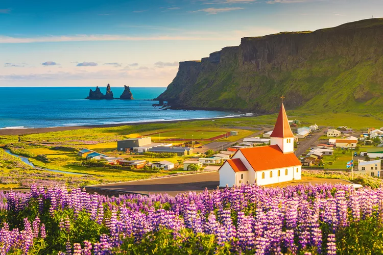
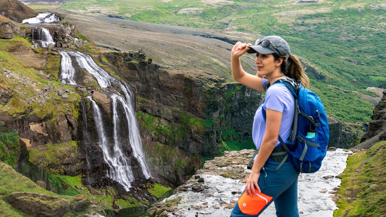
Iceland, a paradise for hikers, has many breathtaking trails that wind through wild and surreal landscapes, including roaring rivers, deep canyons and mysterious valleys. Whether you’re a beginner looking for easy trails near Reykjavik or an experienced hiker looking for challenging glacier hikes, Iceland has something for all.
- Top things to do in Iceland — 12+ must do in Iceland & best things to do in Iceland
- Iceland travel blog — The fullest Iceland travel guide blog for the first-timers
- Zugspitze blog — The fullest Zugspitze travel guide for a spectacular Zugspitze trekking trip
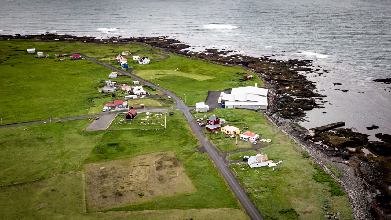
- Arnarstapi Village — Finding peace in the fishing village of Arnarstapi, Iceland
- Vang Vieng river tubing — The fullest guide for tubing in Vang Vieng, Laos

Our complete guide covers everything you need to know, from the gear you need to the best time to explore these stunning trails.
Iceland is a paradise for hiking enthusiasts
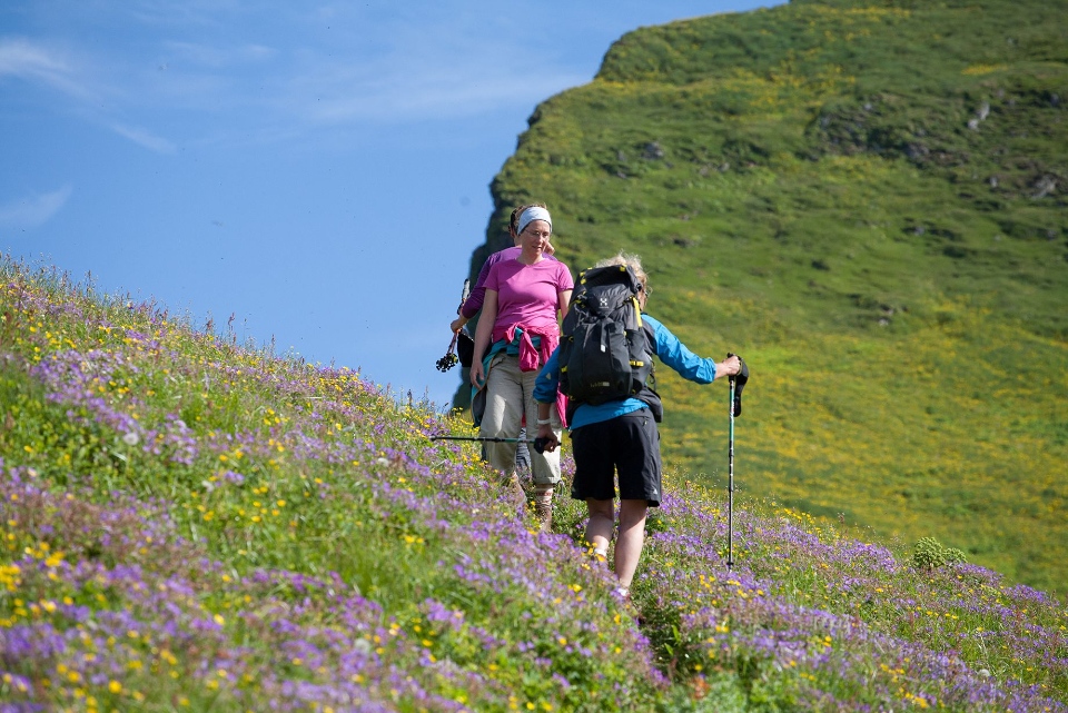
Iceland’s rugged terrain seems tailor-made for Hiking enthusiasts. Diversity of landscapes —from peaceful day hikes suitable for beginners to more challenge glacier hikes.
It is guaranteed that every experience is unique, inspiring hikers to return and conquer new trails year after year.

With three large national parks and many nature reserves, Iceland is committed to preserving its unique ecosystem, including a rich and rare variety of flora and fauna.
Iceland hiking guide: What to bring on your hiking adventure in Iceland?
Hiking in Iceland, like anywhere else, requires careful planning and preparation. Here are the things you should consider before starting your hiking journey in Iceland:
- Hiking time: Know how long your planned hike will take.
- Emergency situations: Do you know the emergency services contact numbers and have the means to call them?
- Equipment and gear: Depending on the length and difficulty of your hike, you’ll need the right gear including a sturdy pair of boots, warm clothes and a waterproof jacket. Always carry a map, whether physical or digital, to safely navigate challenging terrain.
Essential equipment for hiking in Iceland
To fully enjoy the diverse hiking trails that Iceland has to offer, the right equipment is vital. Here’s a checklist for your hike:
- Bottled water: Bring at least one liter every 2 hours of hiking, more if hiking is strenuous.
- Snacks : High-energy snacks like energy gels for tougher hikes and granola bars for gentle hikes.
- Proper footwear: Sturdy hiking shoes are essential for navigating Iceland’s challenging terrain.
- Clothing: Wear layers to adapt to changing weather conditions including waterproof and windproof equipment.
- First aid kit : Always have a first aid kit handy as Iceland’s vast wilderness can make it difficult for rescue teams to reach you quickly.
- Navigation tools: Always carry a map and compass or GPS device. Even in our digital age, these tools are indispensable for safely navigating Iceland’s unpredictable weather and rugged landscape.
Safety
Before heading out, inform someone of your hiking plans, especially if you are venturing into remote areas. Iceland’s search and rescue teams are highly effective but knowing your intended route can help you quickly render assistance if needed.
Also, consider downloading safety apps that allow emergency services to track your GPS location.
Explore Iceland’s hiking trails
From the Laugavegur Trail in the highlands to scenic routes near Reykjavik, Iceland offers a variety of hiking experiences. Explore the trails in Hornstrandir for a remote wilderness experience or enjoy more accessible trails around the capital.
Each area has unique landscapes and challenges, suitable for many different hiking preferences.
Understand the risks when hiking in Iceland
Hiking in Iceland is as safe as anywhere else on the planet. However, that does not diminish the importance of being aware of the potential dangers when exploring the wilderness.
There’s a lot you can do to minimize these risks, such as making sure you’ve packed everything you need along the way (e.g. medical kit, map, clothes, etc.). A well-prepared hiker will be much safer than an unprepared one.
Weather is difficult to predict

One of the most significant risks when hiking in Iceland is unpredictable weather. Conditions can change suddenly, going from bright sunshine to severe thunderstorms in a matter of moments.
While this may be a minor inconvenience in urban areas, it becomes a serious hazard on remote hiking trails. Whether it’s heavy rain, dense fog or a snowstorm, each weather condition requires respect and caution.
Hydration and exhaustion
On longer trips, dehydration and exhaustion are common problems. Although there is plenty of fresh and drinkable glacier water in many rivers, always carry enough water with you.
Before setting off, familiarize yourself with the location of water sources along the route you have chosen. Also, bring energy-rich snacks to maintain your stamina throughout the hike.
Physical fitness is very important. Allow yourself enough time to assess your ability regarding the duration and difficulty of the hike. Overestimating your endurance can lead to difficult situations throughout your journey.
Remember that the beauty of hiking trip is as important as the physical activity itself. Take your time to safely enjoy your surroundings.
Best time to hike in Iceland
Iceland’s scenery is stunning all year round, but the best time to hike is in the summer months of July and August. The weather is most favorable and the days are longest, providing plenty of daylight to explore.
Hikes under the midnight sun in July offer a unique experience, where daylight lasts well into the midnight.
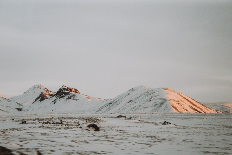
Hiking in winter is less recommended due to shorter days and harsher conditions, but it offers unique opportunities to hike on glaciers and admire the Northern Lights.
If you choose to hiking in winter, be well prepared with the right equipment and consider guided tours to ensure safety.
The best hiking trails in Iceland
Now that you are fully prepared for your adventure and aware of the potential dangers along the trails, you will have to decide which hiking trails to challenge yourself in Iceland.
As mentioned earlier, each region of Iceland offers walking and hiking tours and this variety can make deciding where to go hiking in Iceland a challenge.
Some people even decide to hike across Iceland. A hike from the north coast of Iceland to the south coast of Iceland takes about 18 to 20 days and should only be attempted by experienced hikers. Remember, you will need to bring all of your equipment.
Shorter multi-day hiking trips (from 1-6 days) are more popular, they are asking for an average but manageable level of hikers. The Laugavegur trail and the Fimmvorduhals trail are the country’s most popular hikes.
Other great hiking trails in Iceland to consider are in Hornstrandir, Westfjords, Viknaslodir and Eastfjord. Shorter half-day hikes are possible throughout the country, with several options around Reykjavik.
Each national park and most campgrounds will recommend hiking trails in the area of varying difficulty. Often you can find the best and most up-to-date information there, so be sure to ask campground staff for advice and explore maps at national parks.
Below, we have compiled a list of the most popular hiking trips in the country. Of course, where you choose to explore is entirely up to you.
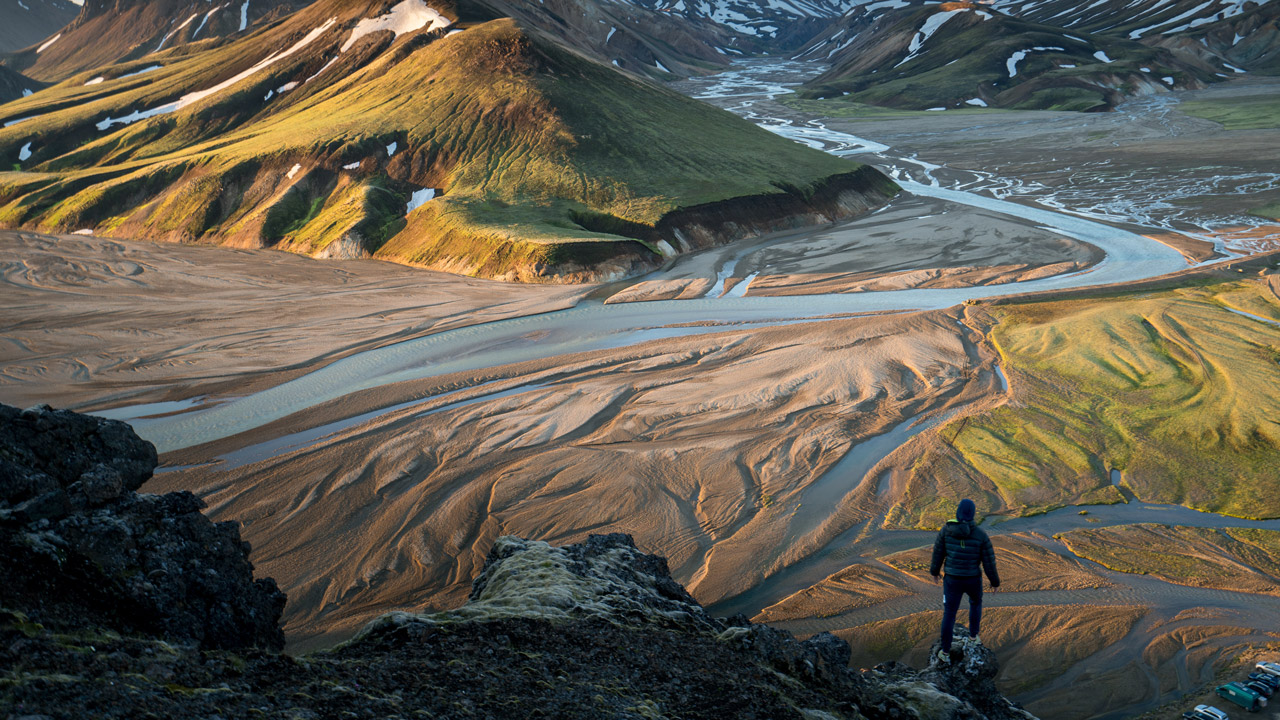
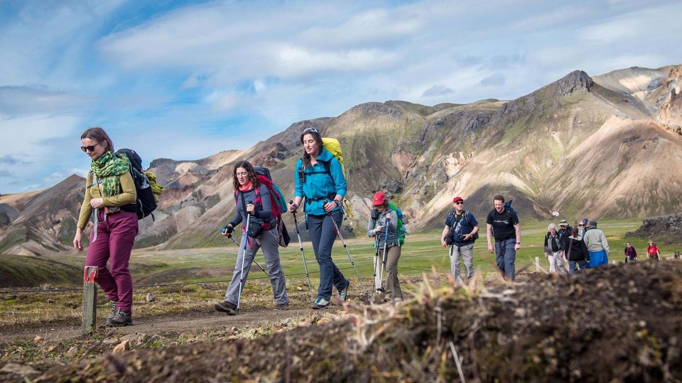
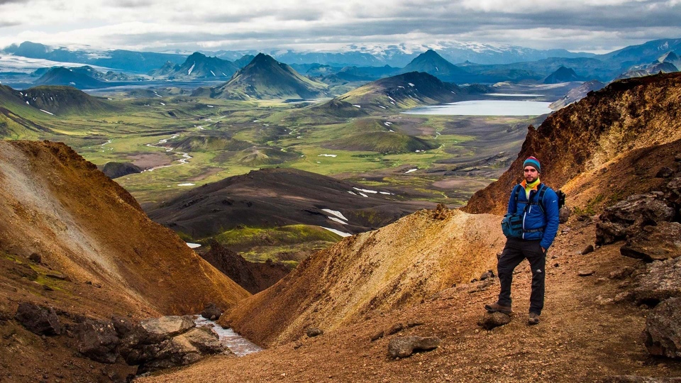
Landmannalaugar trail
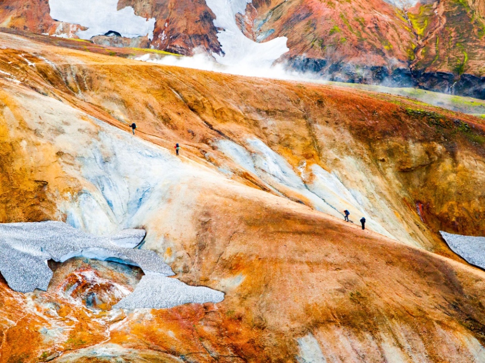
The Landmannalaugar (“People’s Pools”) highland route is considered by many to be one of the best hiking routes in Iceland.
The area’s geothermal activity means the rivers and streams of the Landmannalaugar highlands are warm and perfect for bathing, the optimal way to relax after a day of trekking.
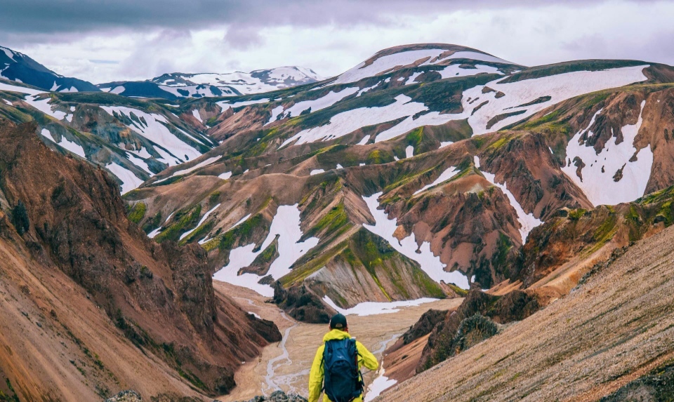
Above all, the rhyolite mountains are a kaleidoscope of oranges, greens, purples and reds. The steep mountains are as elegant as the waves on the colorful ocean.
These colors have long made the Landmannalaugar highlands a must-see for photographers around the world.
You can only reach the central highlands where Landmannalaugar is appeared during Iceland’s summer months, from late June or early July until late September (in good weather conditions).

Laugahraun lava fields to the Brennisteinsalda
This hike will take you from the edge of the “Laugahraun raven lava fields” to the Brennisteinsalda (“Sulphur Wave”) volcano and back.

Brennisteinsalda volcano is 0.5 miles (0.8 km) high and its name comes from the large flecks of sulfur that dot the mountainside. With the red color of iron, the dark green color of volcanic ash and the green color of moss, the Brennisteinsalda volcano is considered the most colorful mountain in Iceland.
- Distance: 4 miles (6.5 km)
- Duration: 2 to 3 hours
- Difficulty: Moderate
Hike up Blahnjukur mountain (#Iceland hiking guide)
The third route is hike to the top of 3,051-foot (940-meter) Mount Blahnjukur (“Blue Peak”). Throughout the hike, you’ll be amazed by the deep blacks and blues of the surrounding lava flows and deposited ash.
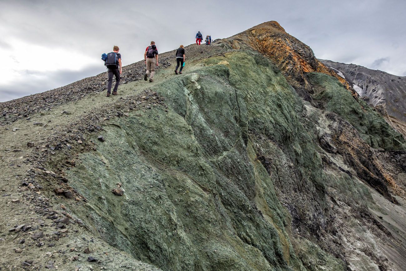
The mountain is located next to the Brennisteinsalda mountain and on a clear day you can see five different glaciers from the summit. This is one of the best hiking trips in Iceland for photographers who are passionate about landscape photography.
- Distance: 4.1 miles (6.6 km)
- Duration: 1 to 2 hours
- Difficulty: Moderate
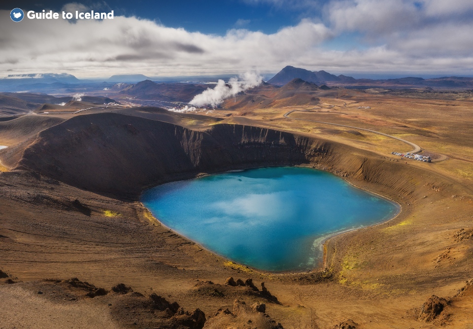
Hike on Ljotipollur Crater Lake
Finally, hikers have the option of trekking to the crater lake Ljotipollur, known in English as “The Ugly Puddle.”
Don’t let the name put you off, as this hike comprehensively demonstrates the incredible diversity of the landscape of the Landmannalaugar highlands. This name does a disservice to the “puddle” itself.
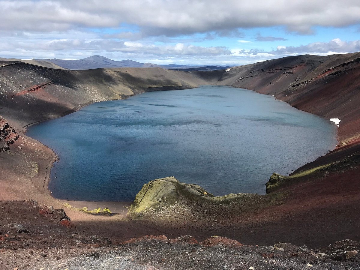
The lake is deep, beautiful and stocked with trout, surrounded by steep red embankments and contrasting sharply with the surrounding dark gravel.
- Distance: 8.19 miles (13 km)
- Duration: 4 hours
- Difficulty: Moderate
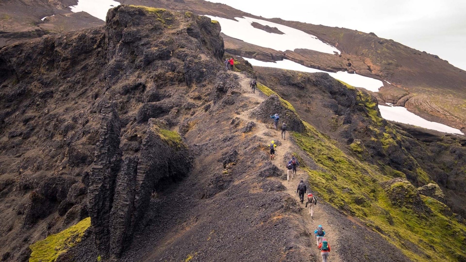
Laugavegur and Fimmvorduhals hiking trails
These two hikes are considered the best in Iceland and can be done together or separately.
Between Landmannalaugar and Thorsmork is the Laugavegur Trail or Laugavegurinn, named after Reykjavik’s main street. The hike between Thorsmork and Skogar is called Fimmvorduhals, or Five Cairn Neck.
Laugavegur Trail
On the Laugavegurinn trail, you won’t find souvenir shops, bars, cafes, clothing stores or galleries – just breathtaking views.
This name can confuse visitors to the island because Reykjavik’s Laugavegur shopping street has the same name as this hiking trail.
But if you are pursuing a hiking trip, decide which way you want to go and travel by bus to Landmannalaugar or Thorsmork to start your hike. Most people choose to start from Landmannalaugar as this gives you less elevation gain.
Traditionally, this route takes 2 to 4 days with overnight stays at mountain huts in Hrafntinnusker, Hvanngil, Emstrur and Alftavatn. There are also mountain huts at the start and end of the hike in Landmannalaugar and Thorsmork.
If you haven’t reserved a tent in advance, you can also camp next to it (but you need to bring your own tent).
- Distance: 34 miles (55 km)
- Duration: 4 days
- Difficulty: Moderate to difficult
Fimmvorduhals Trail
If 34 miles (55 km) isn’t long enough for you, you can extend the hike by 1 day by adding the Fimmvorduhals trail. This is a picturesque area located between the Eyjafjallajokull volcano and the Myrdalsjokull glacier.
The route starts from Thorsmork and continues for 22 km past countless waterfalls, icebergs and volcanic fissures to reach Skogar.
If you only plan to hike the Fimmvorduhals trail and not the Laugavegurinn trail, you should start in Skogar and finish in Thorsmork. The entire hike takes about 10-12 hours and some people decide to do it over two days, spending a night in a cabin along the way.
Hikers of the Fimmvorduhals trail will climb up to 3,300 feet (1,000 meters) to find their way to the end of the trail.
Book your mountain huts through the The Icelandic Travel Industry Association and get a bus ticket for easy travel to and from your starting and finishing points.
Or if you’re driving yourself, you can leave the car in Hvolsvollur and head out on a day tour to Thorsmork in a Super Jeep as you’ll have to cross some dangerous, bridgeless rivers to get there. Then enjoy spending the day of hiking in Thorsmork.
- Distance: 16 miles (25.7 km)
- Duration: 1 to 2 days
- Difficulty: Difficult
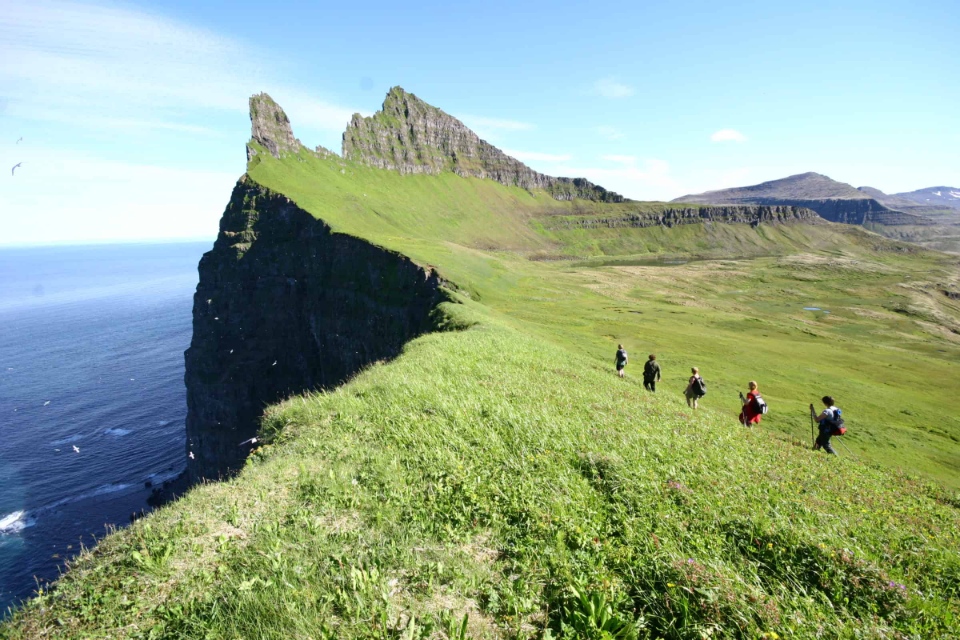
Hiking in the Hornstrandir Nature Reserve in Westfjord
Hornstrandir Nature Reserve, in Westfjord, is one of the most isolated areas in the country, famous for its towering bird-nesting cliffs, complete lack of development, and arctic fox population.
A walk through Hornstrandir Nature Reserve will bring you Icelandic nature like never before. The authenticity of such natural environments is truly breathtaking and offers an experience unlike any other in Iceland.
The area has no stores, no roads and no permanent residents. Essentially, this is one of Iceland’s best backpacking trails into the wild.
Hiking in Hornstrandir Nature Reserve requires at least an overnight stay, so you’ll have to bring everything with you from the mainland.
To get to Hornstrandir Nature Reserve, you’ll have to take a boat from Isajordur or the tiny fishing village of Bolungarvik.
Upon reaching the small harbor of Hesteyri, most hikers will choose to hike the 15km towards the picturesque Hloduvik Bay. Depending on your speed, this will usually take 4 to 6 hours. Several cabins in the bay make this an ideal place to camp overnight.
On day two, you’ll climb the steep slopes of Skalarkambur, a coastal mountain where you’ll get incredible panoramic views of the surrounding fjords. Once you reach the other side of the mountain, you’ll hike a few miles down to a bay called Rekavik (not to be confused with Reykjavik!).
From here, you’ll continue to Hornvik, where you can set up camp for the night. If you have the energy, you can walk a few more hours to the farm at Horn, where you can also set up camp.
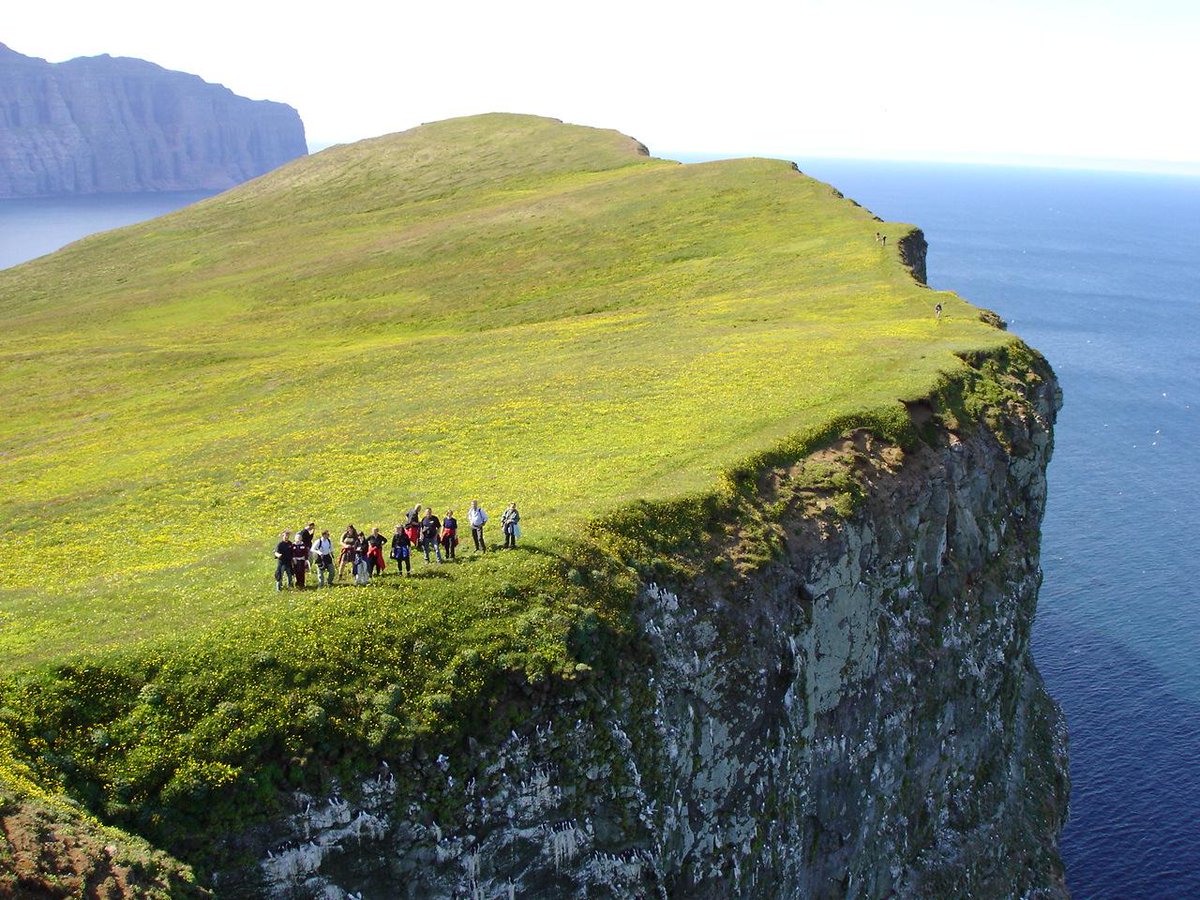
By walking to the farm on day two, you’ll get closer to the incredible bird cliffs (and the crown jewel of the Hornstrandir Nature Reserve), Hornbjarg.
The Hornbjarg Cliffs are immediately enchanting. The setting is a lush green field often decorated with ethereal cloud cover.
Crawling (very carefully) to the edge of the cliff, you will get the perspective of falling 1,640 feet (500 meters) vertically into the ocean, made all the more surreal by the hundreds of thousands of flying seabirds and nest around rock cliffs.
Of course, use common sense when finding your way around the Hornbjarg cliffs. After all, it’s a very, very long way to fall. The cliff face seen in the photo is called Kalfatindar.
Your final day at Hornstrandir Nature Reserve will see you walk over a pass from Hornvik bay into the Veidileysujordur fjord. From here, you’ll sail back to the mainland, where we recommend a fish dinner at the famous Tjoruhusid Restaurant in Isajordur.
Viknaslodir Hiking Trail in East Fjord
The Viknaslodir area in East Iceland has many hiking trails and is often called the “Trail of the Inlets”. You should spend 5 to 10 days hiking here.
The area is divided into North and South, but you can also do a 5-day highlight hike. This road is about 93.2 miles (150 km) long, considered one of the most beautiful hiking routes in Iceland.
Expect majestic mountains, breathtaking seaside vistas, stunning beaches, stunning fjords, colorful mountains, green valleys and clear blue waters.
Note that hiking in this area should only be attempted in the summer, as the roads leading to Borgarjordur Eystri (or East Iceland in general) can be closed in the winter due to heavy snowfall.
So you won’t even make it to the starting point and the huts along the way aren’t open in winter to keep you warm.
Hiking from Borgarjordur Eystri to Seydisjordur
Between the towns of Borgarjordur Eystri and Seydisjordur is a spectacular 34.1 mile (55 km) hiking trail, the same length as Laugavegurinn. The trip takes you along the Eastfjord coast through the town of Husavik and usually takes 3 to 4 days on foot.
Most notable are the stunning views of the North Atlantic passing through small farms and majestic mountains.
- Distance: 34.1 miles (55 km)
- Duration: 3 to 4 days
- Difficulty: Difficult
Best Day Hiking Trips in Iceland
There are many shorter hikes in the countryside of Iceland. Many people start at campsites in Iceland and should ask locals about the best hikes. However, Iceland’s three national parks also offer beautiful and accessible hiking trails.
Here are the best day hikes in Iceland.
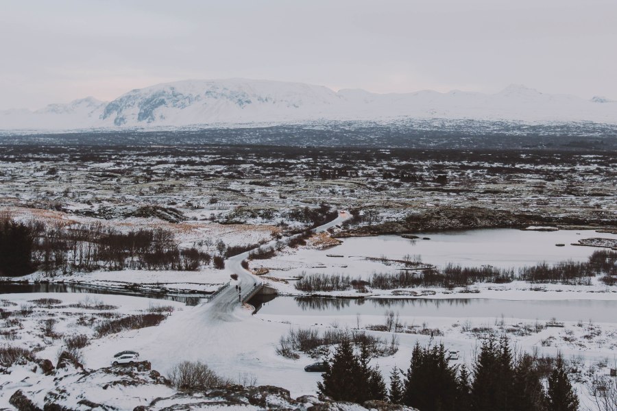
Hike over Oxararfoss waterfall in Thingvellir National Park
At Thingvellir National Park, most visitors hike through the grand Almannagja gorge. The word “Hiking” might not even be appropriate because it is more like a walk. There are wide walkways, many with wooden slats and suitable for wheelchairs.
At the top of the Almannagja gorge, you’ll have views of Iceland’s largest lake, Thingvallavatn, and Oxararfoss waterfall is just a short walk away.
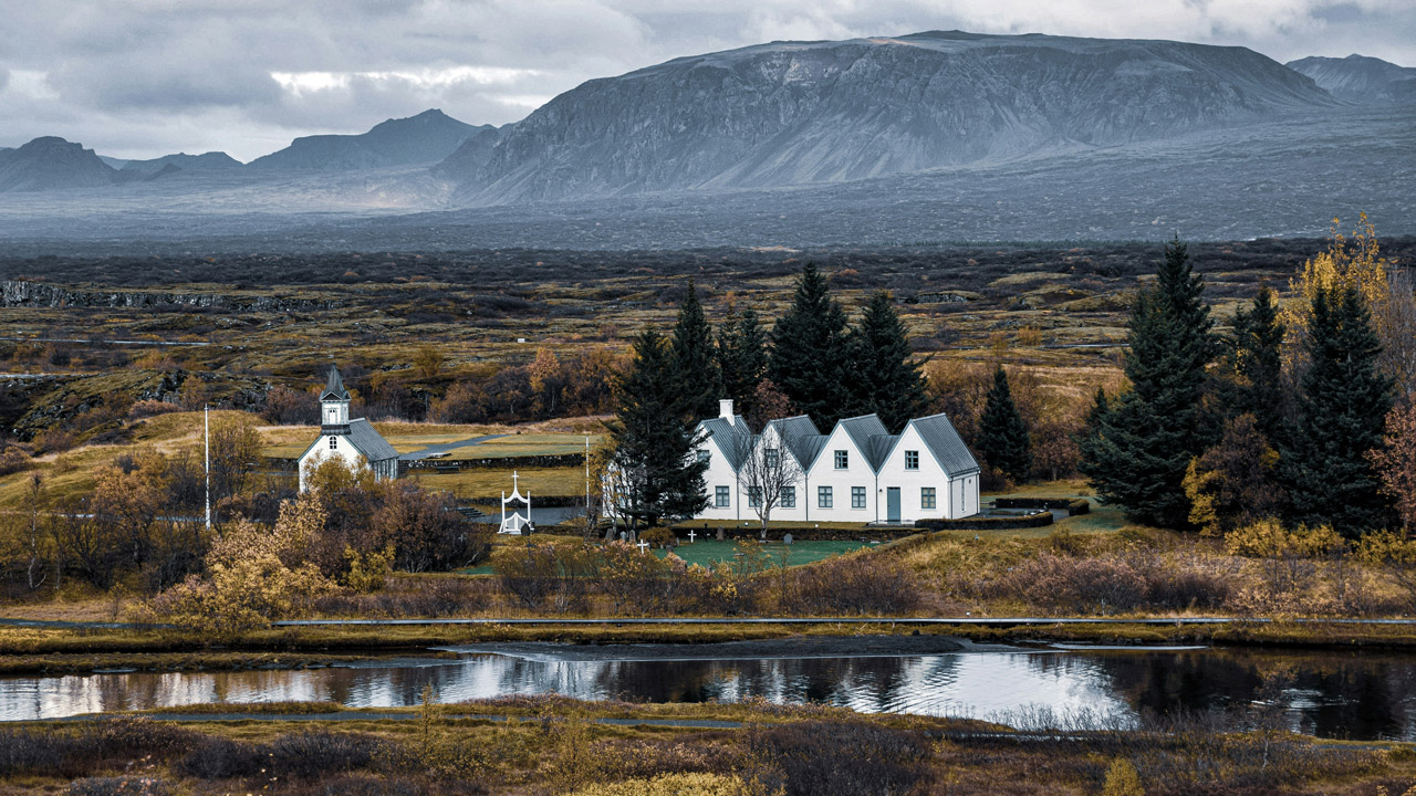
- Distance: 2.6 miles (4.2 km)
- Duration: 1 to 2 hours
- Difficulty: Easy
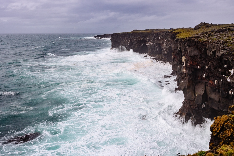
Arnarstapi to Hellnar Hike in Snaefellsjokull National Park
In Snaefellsjokull National Park, there is a popular but easy hiking route between the small villages of Arnarstapi and Hellnar on the Snaefellsnes peninsula.
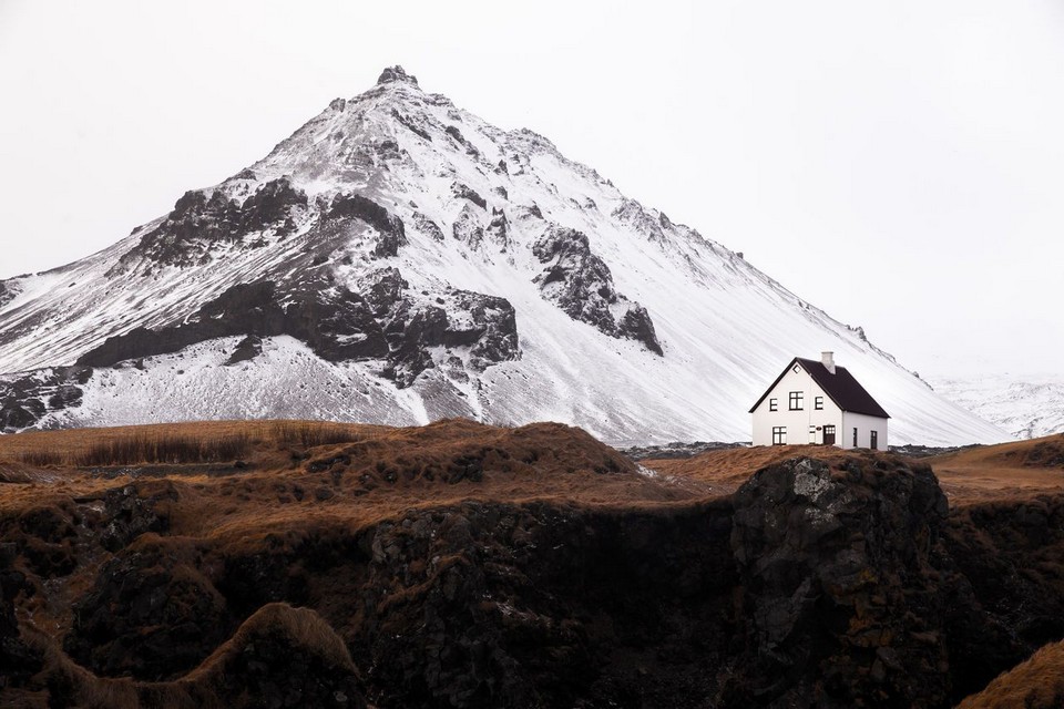
It takes you along the stunning coastline, with some domed rocks, pillars, basalt columns and views of the Snaefellsjokull glacier throughout the route. This hike takes place mainly on flat land, with minimal ups and downs on a narrow path.
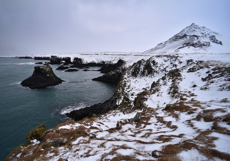
- Distance: 1.9 miles (3.1 km)
- Duration: 1 hour
- Difficulty: Easy
Hike over Svartifoss waterfall in Vatnajokull National Park
In Vatnajokull National Park, there is a beautiful waterfall called Svartifoss, or Black Falls. From the visitor center at Skaftafell Nature Reserve, you can walk quite easily uphill to the waterfall and downhill, then back the same way.
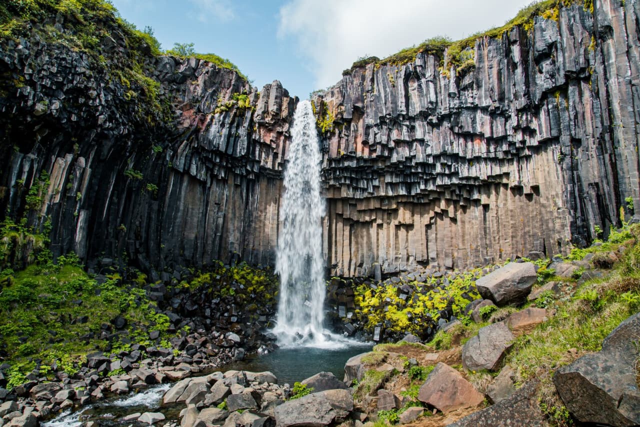
A few other hikes continue around, but this is the easiest, also known as the Waterfall Trail.
- Distance: 2 miles (3.2 km)
- Duration: 1 hour
- Difficulty: Moderately easy
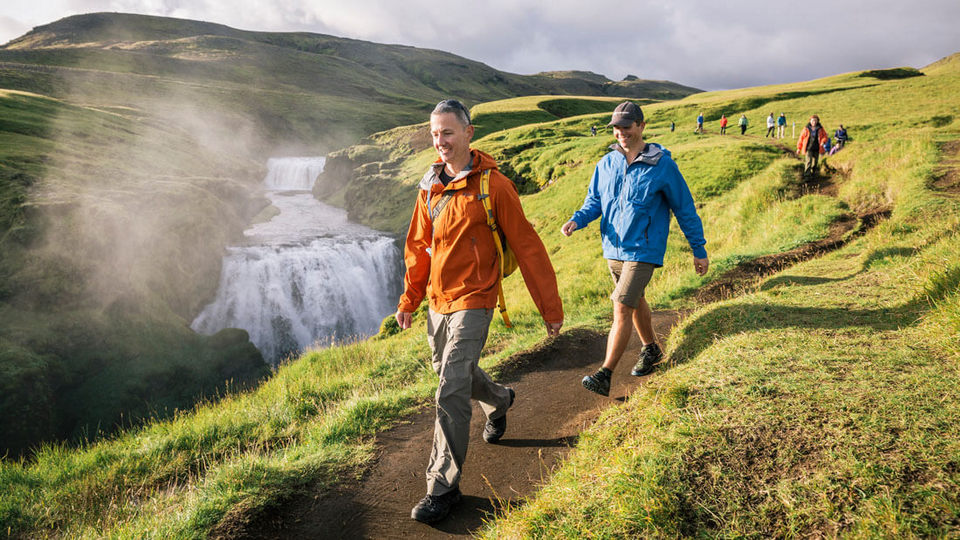
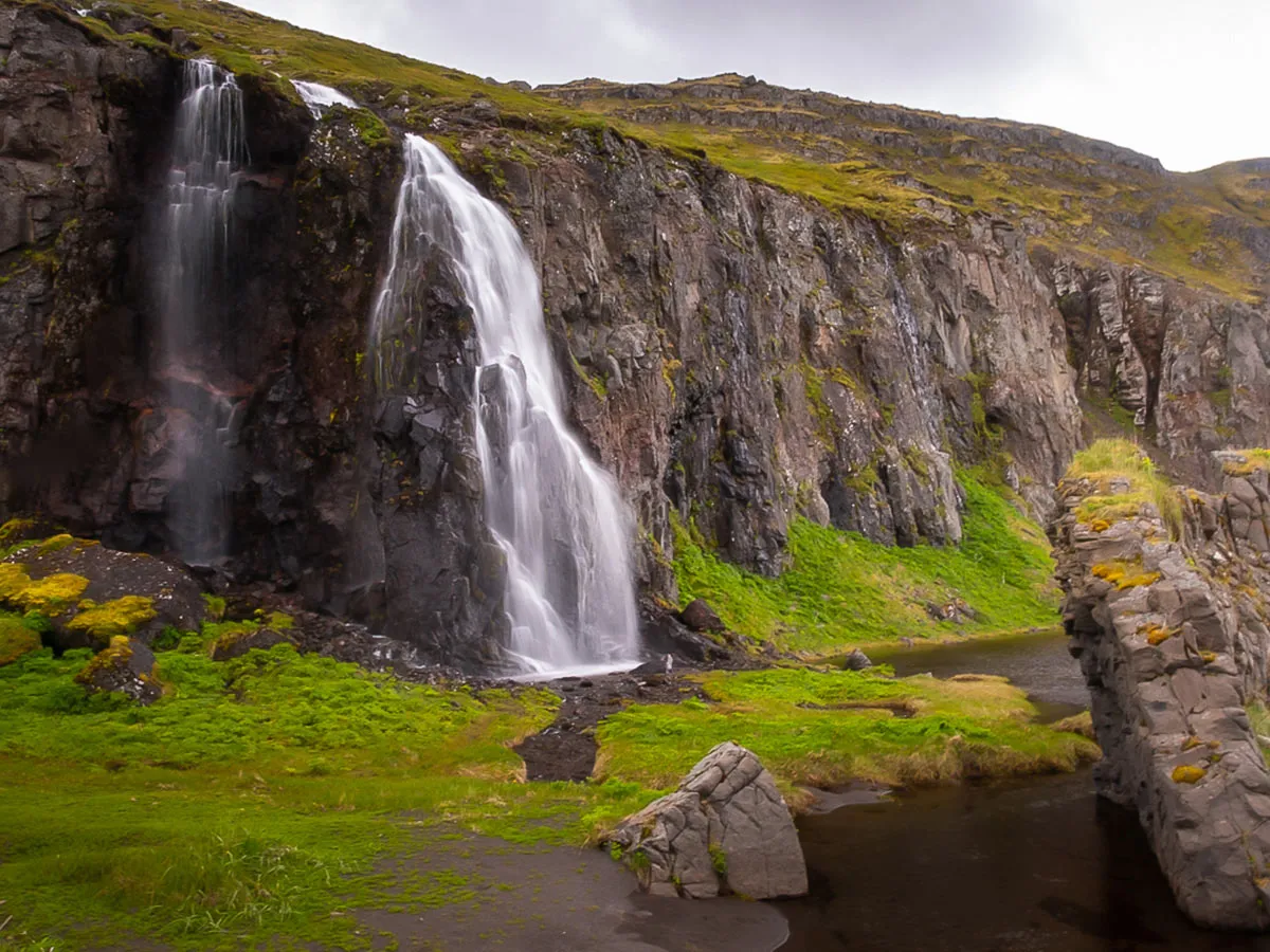
Hike over Skogafoss waterfall
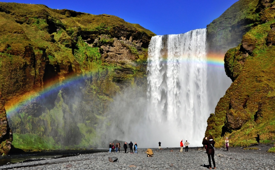
Skogafoss Waterfall is part of the Fimmvorduhals Trail, but as it is one of the first waterfalls you encounter, you can walk there and back. It is the most popular attraction on the south coast, standing over 197 feet (60 meters) tall with a width of 82 feet (25 meters).
- Distance: 4.2 miles (6.8 km)
- Duration: 45 minutes
- Difficulty: Moderate
Hiking from Dettifoss Falls to Selfoss Falls
Dettifoss and Selfoss waterfalls are located in Vatnajokull National Park near Husavik in Northeast Iceland.
Selfoss Falls is located upstream of Dettifoss Falls and has two east and west sides. The east side is a better place to see Selfoss Falls in all its glory, while the west side trip is shorter.
You can walk both paths if you’re driving because they both start with a parking lot and take on a fun trek.
- Distance: 2.2 miles (3.5 km)
- Duration: 1 to 2 hours
- Difficulty: Easy
Hiking from Seljalandsfoss Waterfall to Gljufrafoss Waterfall
There is an easy hike between Seljalandsfoss and Gljufrafoss waterfalls in South Iceland near the town of Thorsmerkurvegur.
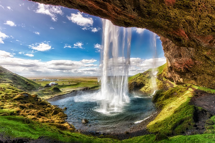
The water comes from the Eyjafjallajokull glacier and there is a small cave behind the Seljalandsfoss waterfall. With an altitude of 200 feet (60 meters), be prepared to get wet from the spray if you want to enter the cave.
- Distance: 1.9 km
- Time: 30 minutes to an hour
- Difficulty: Easy
Hike up Gullfoss waterfall
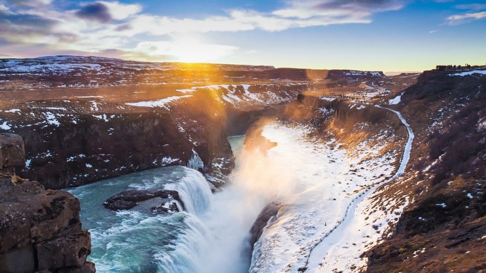
One of the top attractions in Iceland, Gullfoss Falls is a wide waterfall located on the Golden Circle route, so it’s best to visit early. Even in winter, 358 cubic feet (109 cubic meters) of water fall every second, creating an impressive sight.
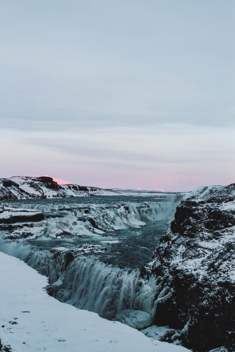
- Distance: 1.3 miles (2.1 km)
- Time: 30 minutes to an hour
- Difficulty: Easy
Walk around the Reykjavik area
If you are looking for the best day hiking trip from Reykjavik then you have plenty of options. The following are just a few examples and we recommend that you research further options.
Hiking in Reykjanes Peninsula
Almost everyone who goes to Iceland will visit the Reykjanes peninsula at one point or another during their trip.
After all, it is home to Keflavik International Airport, the world-famous Blue Lagoon, the “Bridge Between Continents” in Sandvik, the Krysuvik geothermal area, and many other towns and cultural attractions.
Reykjanes Peninsula is more suitable for those who want to hike near Reykjavik. The peninsula’s landscape is dark, diverse, rugged and full of opportunity, be it vast areas of geothermal activity, hidden cave networks, towering mountains or stunning coastlines.
Hiking up Mount Keilir
One of the most popular and accessible hikes on the Reykjanes Peninsula is to climb to the top of the conical hyaloclastite mountain, Keilir.
The peaks are 1,280 feet (390 meters) high, with steep, wide slopes that challenge the unfit and unprepared hiker. Due to the high altitude, many hikers choose to climb to the top of Keilir when the ground is still frosty to avoid slipping on mud and loose gravel.
- Distance: 4.4 miles (7.1 km)
- Duration: 2 to 3 hours
- Difficulty: Moderate
Hiking from Hafnir to Hafnaberg
Another available route is to hike from the fishing settlement of Hafnir to the low cliffs, Hafnaberg.
Hafnaberg is a favorite spot for local bird watchers and visitors can expect to see nesting razorbills, fulmars, guillemots and many other species.
The cliffs at Hafnaberg are also popular viewpoints for watching whales, dolphins and seals swimming off the coast of Reykjanes. Just make sure not to stand too close to the edge of the cliff. The rocks are notoriously unstable, so it’s best to stay back a few meters to avoid accidents.
Participants of the Hafnir-Hafnaberg Hiking will also have the opportunity to see two other important sights of the Reykjanes Peninsula.
The first is the “Bridge Between Continents,” also known as Midlina or “Leif’s Lucky Bridge,” a 49.2-foot (15-meter) long passage between the North American and Asian tectonic plates -The Europe is exposed. On one side of the bridge there is a sign saying “Welcome to America”, on the other side “Welcome to Europe”.
- Distance: Driving distance is 8 miles (12.8 km)
- Duration: 40 minutes
- Difficulty: Easy
Hike to Reykjadalur Hot River Valley
Reykjadalur Valley (“The Valley of Steam”) is another option for those who want to explore the Reykjavik surroundings to the fullest.
As the name suggests, Reykjadalur is a geothermal area, popular with hikers as well as those who like to relax in rivers and naturally heated pools.
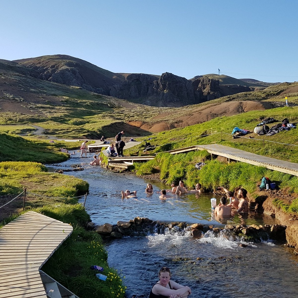
Of course, there’s no reason to choose one or the other. Relieving stress on the body in a heated swimming pool is probably the best, most immediate way to relax muscles after hiking.
Reykjadalur Valley is considered a fairly easy hike and has a wonderful variety of natural attractions, from steaming volcanic craters to dramatic mountain scenery to roaring waterfalls.
- Distance: 4.3 miles (seven kilometers)
- Duration: 2 hours each way
- Difficulty: Easy
Hike up Mount Esjan
Esjan is a Reykjavik mountain, overlooking the outskirts of the city. To get to the foot of the mountain and start the hike, you can take the Straeto city bus (number 57 or 29). The bus stop is called “Esjuraetur – Hiking Center”.
The mountain isn’t very high, only 3,000 feet (914 meters) high, but don’t let that fool you. It’s quite a difficult hike, especially near the summit where some climbing is required. There are ropes and steps provided to climb to the top.

You can also just do short walks as the hike up is divided into six sections, the top of which is at Thverfellshorn, 2,560 feet (780 meters) high. This section is the most popular hiking route to the top of Esjan, although there are other ways as well.
Hiking to the top is not recommended in winter except for experienced hikers. Day-to-day conditions must always be considered, as there have been fatal incidents where avalanches have occurred at times of the year when there is heavy snow.
However, the views are amazing and accessible all year round (depending on the weather) and the hike to the top is only about 2 hours and the descent is much quicker. If you stop at Steinn, the walk will be easier and more family-friendly.
- Distance: 8.7 miles (14 km)
- Time: 3-4 hours
- Difficulty: Moderate to difficult
Hike to Mount Helgafell
About 11.7 miles (18.8 km) south of Reykjavik is Mount Helgafell. It is very close to Hafnarjordur town and is a famous hiking trail for locals.
The mountain is only 1,152 feet (351 meters) high and it takes an hour and a half to hike to the top (perfect for bringing kids along). You’ll then be rewarded with an impressive view over Reykjavik and towards the Reykjanes peninsula.
Most people start the hike from Kaldarbotnar, where a clear trail can be found. The first part of the trail follows flat lava until you reach the northeast side of the mountain, after which you can hike up the ridge all the way to the summit.
- Distance: 6.5 miles (10.5 km)
- Duration: 3 to 4 hours
- Difficulty: Medium
Hike to Glymur Falls
Glymur Falls is Iceland’s second highest waterfall after Morsarfoss Falls and is much more accessible. First, however, you have to drive 31.6 miles (50.8 km) from Reykjavik to the Hvaljordur fjord.
The hike goes through a natural cave and crosses the river on a large tree trunk before climbing up a fairly steep mountainside.
However, the scenery is beautiful and varied, and if you find the climb too tiring, you don’t have to go all the way to the top of the falls, only then you can enjoy a panoramic view of the falls. It takes about 1 hour of hiking.
It is possible to walk to the top of the waterfall on both sides of the river, you can then cross the river at the top of the falls (depending on conditions) – just a few feet from the actual drop!
To get to the starting point, you need to rent a car and drive to the nearby parking lot in Botnsdalur as there are no bus routes going there.
Another much longer hike called Leggjabrjotur (Legbraker) starts from the same location and ends at Thingvellir. That hike is about 11.8 miles (19 km) but only one way.
- Distance: 4.3 miles (6.9 km)
- Duration: Approximately 3 hours to complete the loop
- Difficulty: Moderate
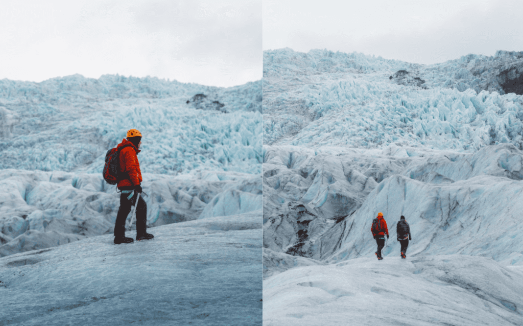
The best glacier hikes in Iceland
Some of the best glacier hiking routes in Iceland is near the Skaftafell Nature Reserve and perhaps the most demanding trail in the area to reach Iceland’s highest mountain: Hvannadalshnukur.
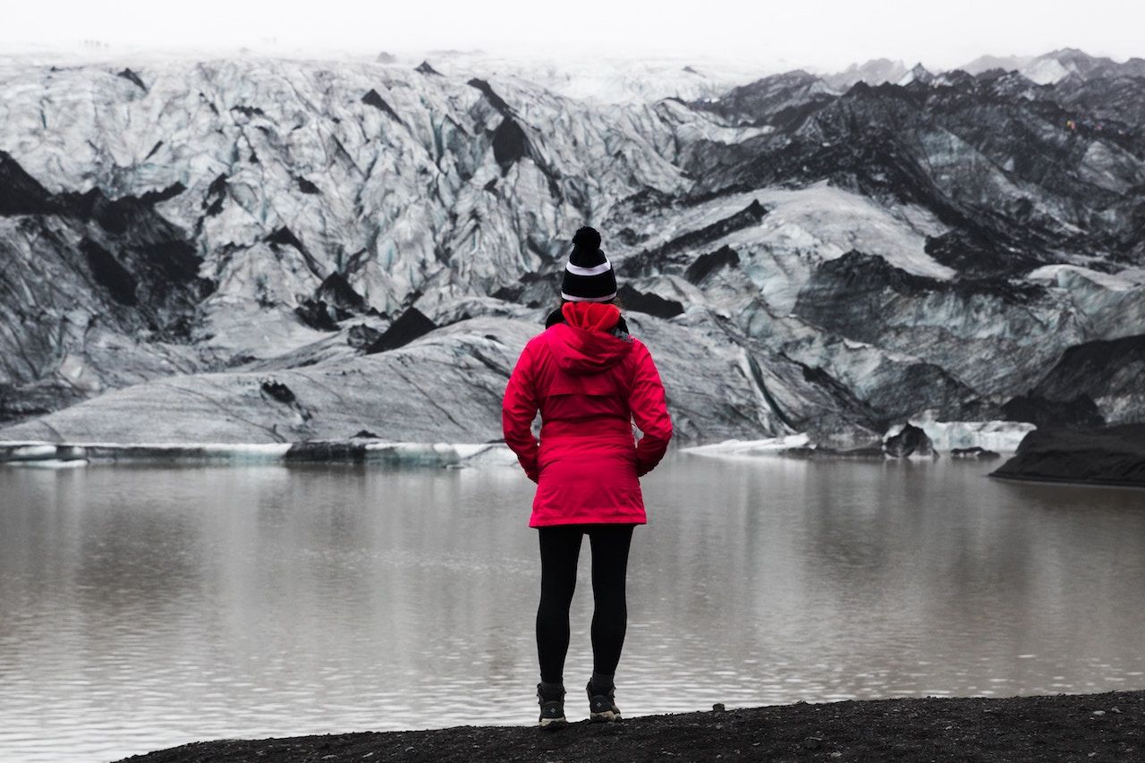
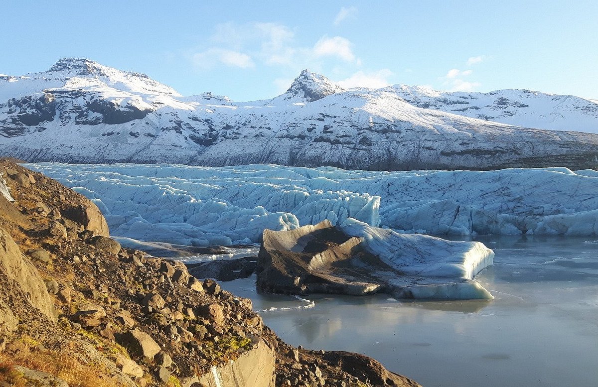
Many Glacier Hiking tours are part of multi-day tours of the stunning Jokulsarlon Glacier Lagoon.
Hiking Hvannadalshnukur in Vatnajokull National Park
To hike up Hvannadalshnukur mountain, you will need a lot of stamina and an experienced mountain guide. Hikers must hike with a harness and rope, so you should have previous experience hiking on ice.

Hvannadalshnukur mountain is 6,923 feet (2,110 meters) high with many crevasses and incredible heights.
This is the highest peak of the Oraefajokull volcanic glacier in Vatnajokull National Park. So, although this is a beautiful hike, you should assess your abilities and equipment before attempting this hike.
- Distance: 18 miles (28.6 km)
- Duration: 10 to 15 hours
- Difficulty: Difficult
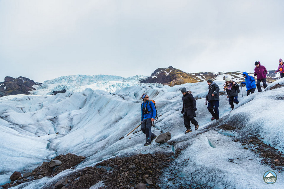
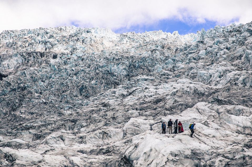
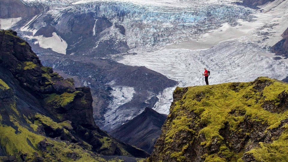
Hike on the Svinafellsjokull glacier
With the high hiking level of Hvannadalshnukur mountain, the most popular glacier hiking destination is Svinafellsjoukill glacier. It is a glacier of Vatnajokull with many sharp ridges that create impressive photos.
The higher altitude also means you can see all the other glaciers and mountains of Vatnajokull National Park and beyond.
Although summer is less cold, winter is the best time to visit for its vivid blue and the chance to see ice caves. This is perfect for adventurous travelers to Iceland and is one of the top-rated Glacier Hiking trails in Vatnajokull.
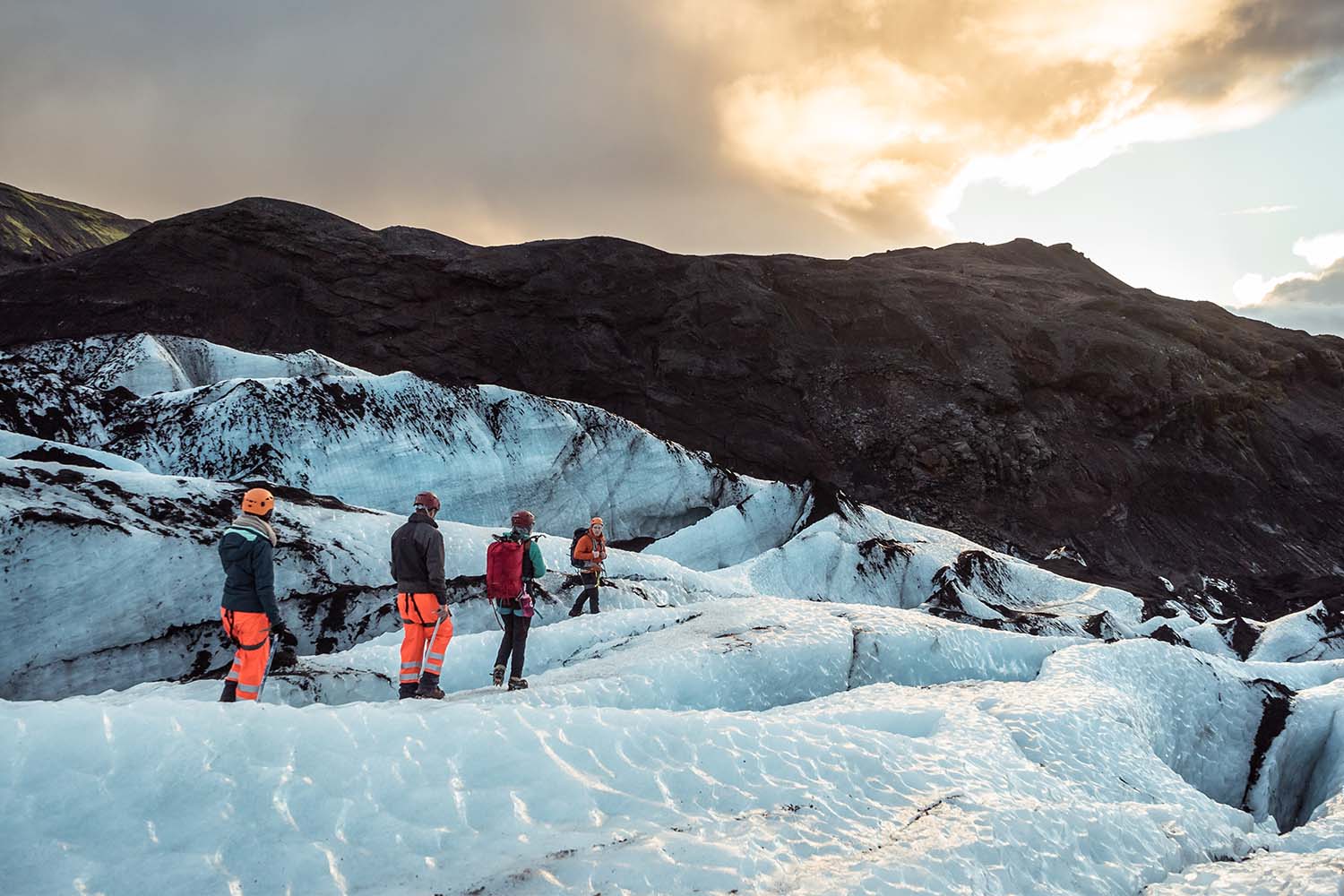
Hiking on Falljokull glacier
Falljokull Glacier is called the “Falling Glacier” because its massive ice falls create a stunning sight. It is the outlet glacier of the Oraefajokull Glacier in South Iceland, which is the outlet glacier of the Vatnajokull Glacier.
There is a guided Glacier Hiking on Falljokull Glacier with transfers from Skaftafell and possible ice cave tours in winter.
- Distance: Varies depending on tour
- Duration: 3 to 5.5 hours
- Difficulty: Difficult
Hiking on the Solheimajokull glacier
Solheimajokull Glacier in South Iceland is a closer option for those coming from Reykjavik. It is located near the Eyjafjallajokull volcano and glacier hikers can sometimes see the volcano.
It stands out because there are no high mountains around, offering great views, and the nature of the ice means you can ice climb. You can opt for a Glacier Hiking tour to the Solheimajokull Glacier or combine it with a longer trip.
Additional Hiking trails in Iceland
The areas mentioned above are just a selection of the best hiking trail in Iceland. For those who do, be pleased to know that almost anywhere you go in Iceland there is a great place for a nice Icelandic hike or stroll.
Other notable areas include the area around Lake Myvatn, such as the Dimmuborgir lava field and the Hverfjall volcano.
Various locations in South Iceland, the coastline of the southern part of Eastfjord, the Snaefellsnes peninsula and many other areas in the Icelandic Highlands, such as the Kerlingarfjoll Mountains or the Hvevellir geothermal region.
So don’t delay! It’s time to plan a hiking trip in Iceland and experience for yourself the majesty of the “Land of Fire and Ice!”
The post is complied by Living Nomads from many different sources. If you find any images or text that belong to you, please contact us, so we can credit you or give us permission to use them. Thank you very much!
Some best day tours, trips, activities and transfer services, tickets in, from and to Iceland you can refer to
- Golden Circle & Friðheimar Greenhouse Cultivation Day Tour
- Reykjavik Walking Tour
- Hop On and Hop Off Bus in Reykjavik
- Hop On and Hop Off Iceland Bus Passport
- South Iceland Tour from Reykjavik
- Golden Circle Tour and Kerid Crater Day Tour
- Jokulsarlon Glacier Lagoon and South Coast Day Trip
- 2 Day South Coast and Glacier Hike from Reykjavik
- Premium Southern Iceland Small Group Day Tour
- Lava Caving and Silfra Snorkeling Tour from Reykjavik
- Secret Lagoon Ticket and Transfers from Reykjavik
- Snæfellsnes Peninsula Full Day Tour from Reykjavik
- Blue Lagoon Ticket with Round Trip Transfers for Reykjavik
- Keflavik Airport (KEF): Bus Transfer to/from Reykjavik
- Silfra: Fissure Snorkeling Tour with Underwater Photos
- From Húsavík: Traditional Whale Watching Tour
- Húsavík: Big Whale Safari & Puffin Island Tour
- Húsavík: Whale Watching Tour with Guide
- Keflavik Airport & Reykjavik Hotels: Economy Bus Transfer
- Iceland: Northern Lights Bus Tour from Reykjavik
- Reykjavik: Golden Circle Full-Day Tour with Kerid Crater
Are you looking for more top things to do in Iceland: Tours, activities, attractions and other things? Let’s check it out at here.


